
Glasgow is a city of displaced ghosts. These are not the banshees and the bogles of our nightmares, but restless spirits, forever trudging the streets and pathways, unable to haunt the landmarks of their lives. The tenement where they were born? Flattened under the tarmac of the M8 that rips through the centre of the city. The primary school where they played with their friends? Left to crumble, sprouting greenery and mold, before being consumed by fire. The church, where they married? Rubble beneath the foundations of a glass and plastic office block.
Glasgow has always transformed itself, and not always for the better. In Glasgow: 1830 to 1912, is the tale of an American visitor in the 1840s, who described the city as “one continuous building site”, and the story of how artist, designer and conservationist William Morris was shocked to discover, during his 1880 stay here, that refurbishment of the medieval cathedral had involved the destruction of its 13th century clocktower.
In 2022, in addition to the tireless work of organisations such as the New Glasgow Society and the Glasgow Building Preservation Trust, concerned citizens use social media to rail against the loss of beloved landmarks and buildings, and this is helping to drive a more considered approach.
Nevertheless, change through demolition seems to be a model rooted in this city’s DNA. Despite this, one human-made structure has endured since 1790, surviving wars, pandemics, post-industrial collapse, and even its closure in 1963 – the Forth and Clyde Canal, where the Glasgow branch sits like a crown atop the city.
When I first began to visit this area of the canal, more than 40 years ago, it was an unsettling place. Not many would walk and cycle this section of the canal for pleasure, though it was still a route to and from work for some. The canal was full of rubbish. Abandoned shopping trolleys, bits of cars, forgotten toys, commercial waste – it all clogged the waterway. Wooden locks were splintered and broken. Intricate iron mechanisms were rusted and worn. It held dangers, too. Yet there was still a sense of escape here. Just a few steps from the busy street, it was a rare wild space. I would pick brambles along the towpath, and watch the men who sat, feet dangling over the edge, as they fished the murky waters.
That the canal endured long enough to kick-start its own evolution, was the result of decades of hard work, much of it by dedicated volunteers along with charity the Scottish Waterways Trust, which is no longer operating. Their efforts were not in vain. In 2001, the Forth and Clyde Canal reopened as part of the £83.5million Millennium Link, the biggest British canal restoration project.
People have always reshaped and reimagined their environment, but it’s interesting to see how even the smallest changes can be significant, and the ongoing development of the Glasgow branch of the Forth and Clyde Canal shows what can be achieved through sustainable, community-led and focused projects.
However, while we often cherish these places of our own and our city’s recent past, what we may not realise is we are already living in a landscape chiselled and marked by thousands of years of human endeavour. A walk along one stretch of the Forth and Clyde Canal, beginning on the main run of the waterway and taking the Glasgow branch into the city centre, is a stride through 2000 years.
Possil Marsh
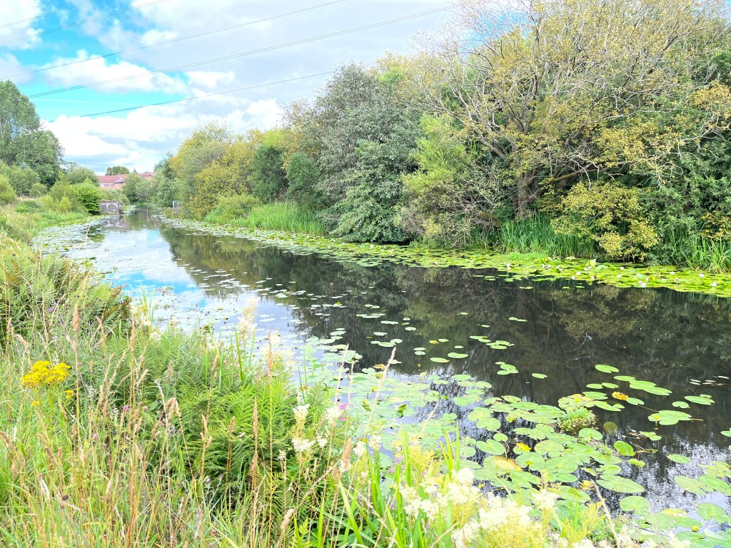
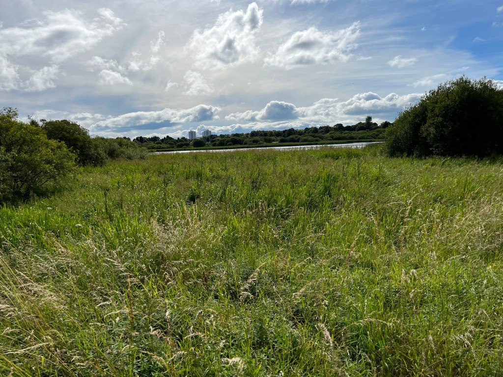
It’s a warm, sunny afternoon when I start out along the towpath of the Forth and Clyde Canal, close to Possil Marsh, with just a gentle breeze to ruffle the grasses and the bulrush, and a splash or two from the moorhen navigating through the lily pads on the water. Broom pods pop and crack in the heat, as I dip between the bees and the dragonflies to pick raspberries from the overgrowth. In this tranquility, in this beautiful spot, I have a sense of being lost in time, as though the clock has somehow stopped, and I have been left here to drift in aimless enjoyment.
My reverie is halted by the trill of bicycle bells as a group of cyclists pedal past, and I step to the side, by a path that leads through to the marshland, now managed by the Scottish Wildlife Trust, and Possil Loch.
I’m momentarily startled, but I can only imagine the fear and alarm of the people who lived and worked here 218 years ago, when a blazing meteorite burst tumbling from the sky above them and plunged to the ground. The event of April 5, 1804, created a thunderous crack that could be heard 25 miles away, with quarry workers describing the “fizzing” of this fiery rock on the last seconds of its celestial journey. The meteorite did still have a little more travelling to do, with the biggest fragment of the four-and-a-half-billion years old treasure now in the Hunterian Museum, at the University of Glasgow.
However, the drama of the High Possil Meteorite fall, and the location of the quarry, now a nature reserve, close to the nearby site of a Roman fort at Balmuildy, is the spot where I’ve decided to begin my walk, with the bold claim of covering 2000 years in five miles.
The Antonine Wall
Sea to sea, the Forth and Clyde Canal shadows and criss-crosses the Roman Antonine Wall, built around 142AD. The wall was around 37 miles long, strung out from Old Kilpatrick on the west coast to Bo’ness in the east, and was occupied for just over 40 years, until the Second Legion retreated to Hadrian’s Wall in the south.
The site of Balmuildy fort lies just over the fields and the Glasgow boundary from Possil Marsh, near the farm that shares its name, and you can still see traces of the ditch and outer mound in the surrounding grounds. One of only two of the Antonine’s forts to have stone ramparts, Balmuildy is also unusual in that the wall crossed the River Kelvin here. In their short stay at Balmuildy, the soldiers, many from Syria, Spain and Algeria, as well as Rome, may have been accompanied by a civilian settlement too. Small leather shoes, a touching hint at the presence of women and children, have been excavated from the site.
When Rome pulled back from the Antonine Wall, not every soldier will have gone. Some will have stayed on, and become part of the communities that continued to grow and thrive across Scotland. Balmuildy may have left much more of a legacy than just pottery, coins and stone.
In his 1922 book The Roman fort at Balmuildy, Stuart Napier Miller wrote “it is clear that in the 18th century considerable traces still showed above ground” although in 1755 they were “very much defaced”, with the fort serving as a quarry “until none of its walls was left standing”. In the early part of the 19th century, he says, “a small hamlet of a dozen cottages existed within the ramparts” of the fort which were “entirely built from the Roman ruins”, some of which included “finely sculptured stones” in the walls of the cottages.
Is it too fanciful to imagine some of this stonework may yet sit, unknown, in parts of other houses in the area – or even form part of the canal?
The Forth and Clyde Canal
John Smeaton, the famous civil engineer, first surveyed for the canal in 1763, with work beginning in the east and reaching Stockingfield Junction before the money ran out in 1775. It was another seven years before work restarted, as Smeaton’s student Robert Whitworth took over, his work including the flight of locks at Maryhill, and the soaring Kelvin Aqueduct, However, the world’s first sea to sea ship canal didn’t fully open until 1790, when the Glasgow branch was extended to Port Dundas, making the link to the Monklands canal. By the mid 19th century, more than 3million tonnes of goods and 200,000 passengers were travelling the canal each year, with steamboats and Clyde puffers going on to become a common sight.
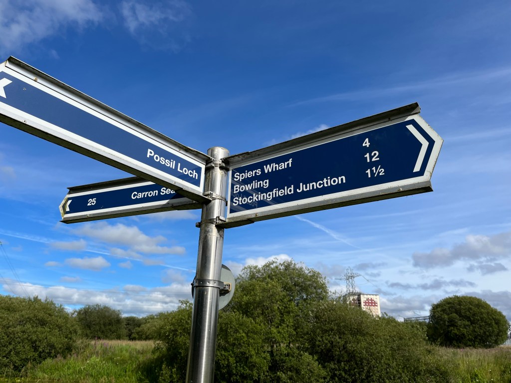
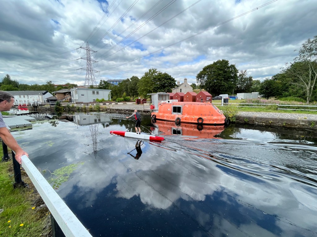
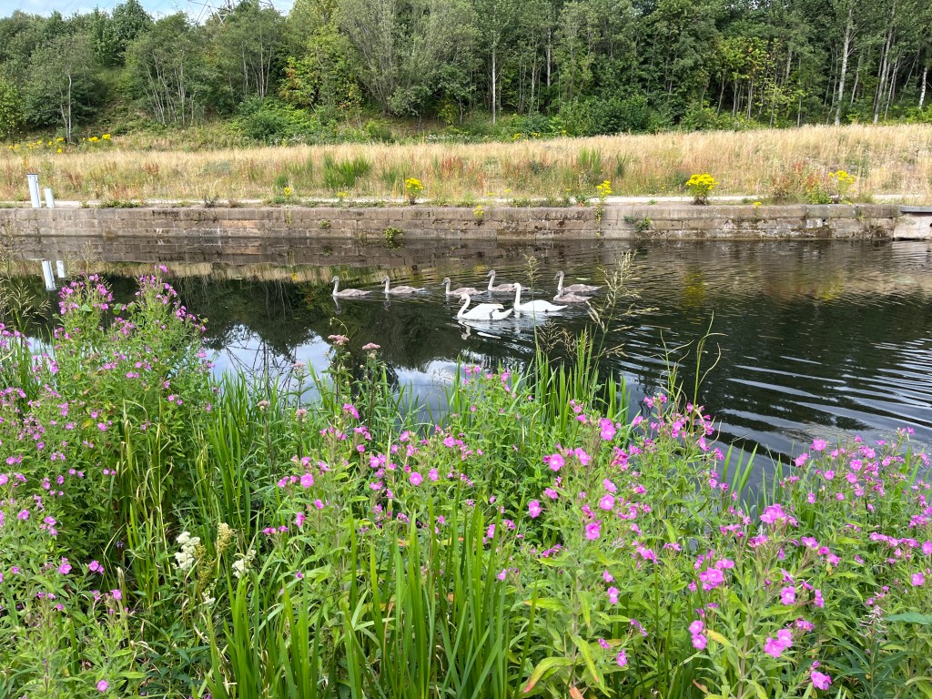
These days, canal traffic is a little less congested. On May 26, 2001, the reopening of the canal was celebrated with a fleet of around 40 boats sailing from Falkirk to Bowling, and many communities now hold regular canal festivals, with lots of people enjoying the chance to get out on the water. Otherwise, the occasional barge will make the journey coast to coast, and some are permanently moored along the Glasgow branch, with several at Speirs Wharf. In addition to canoes and kayaks, I’ve seen rowing boats here and there, and also spotted a paddle boarder, weaving through the ducks and swans.
At Possil Loch, near Glasgow’s boundary with East Dunbartonshire, all is calm as I walk in towards Stockingfield Junction, with the canal taking a meandering route. The high tree-line creates the impression of wilderness, before the darkest months that will expose streets of houses, industrial units and busy roads that lie just beyond the bare branches.
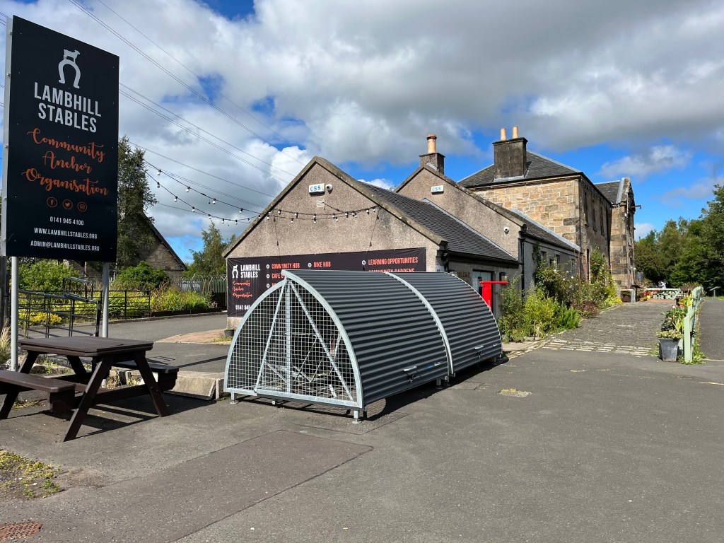
I reach Lambhill Stables, where there is the chance to stop for a breather, and enjoy a cuppa at the cafe. This building, dating from around 1815, was a staging post for the horses that pulled boats and barges along the canal. It was acquired by the local community in 2007, and they have created a busy venue, where there are opportunities for learning new skills through creative and social activities, while also caring for the environment. The bike hub provides sales, repairs and hire, and the popular community kitchen and cafe is still run mainly by local volunteers.
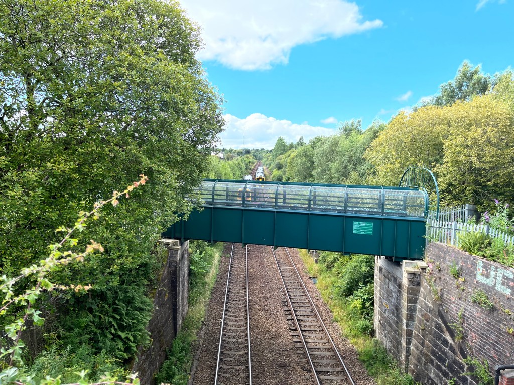
From Lambhill Stables, I walk on, as the canal lifts over the tracks, one train slowing on its approach to Gilshochill, the other charging on to Possilpark. A powerful reminder of the role the railways would play in the eventual demise of this canal. For me, meanwhile, the gleaming white flats and houses of Lochburn Road, running alongside the towpath, mark my way to Stockingfield Junction.
Stockingfield Bridge
At the junction, the main canal continues west on to Bowling, and the Glasgow branch veers south-east towards the city centre. Towering over this intersection, is the new Stockingfield Bridge, a majestic £13.7million construction that unites the communities of Ruchill, Gilshochill and Maryhill.
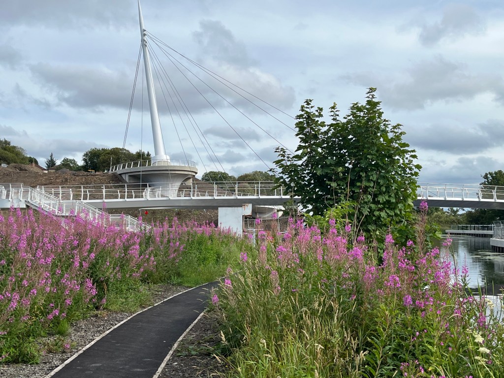
The foot and cycle bridge, in its final stages of completion in September 2022, was funded mainly by walking, wheeling and cycling charity Sustrans, with additional cash from Glasgow City Council, and the whole project has been delivered by Scottish Canals. Stockingfield Bridge not only provides access between these three communities, but it also opens up a route to the west end and city centre, expanding opportunities for both employment and leisure. Artwork, such as the ceramic tiles produced by local artist Louise Nolan in collaboration with schools and community groups here, will also adorn this incredible bridge site.
I heard one TV commentator say it was the canal that had initially divided these communities, which is perhaps a little off-target. In fact, the building of the canal and the economy it generated, are what helped to create these communities, particularly Maryhill, as we know them today.
The Glasgow Branch
There is little to be seen now of the many bank-side industries that once lined the canal all the way to the city centre, the printworks, paper mills, glassworks, foundries, grainstores, breweries and distilleries. However, in another echo from the past, the building of this canal, and the railway, together with the subsequent growth of local industry, brought many workers into this area, including from Ireland, who then settled here.
Maryhill Road accompanies the canal along this section, past Lochburn Park’s Maryhill FC, and the Charles Rennie Mackintosh-designed Ruchill Church Hall just a few yards away from the towpath in Shakespeare Street, before the bridge lifts the waterway over Ruchill Drive and on to Firhill Basin, where Garscube Road takes over shadowing duties for a spell.
The canal passes Ruchill Park and Murano Street student village, the street where glassworks once thrived, named after the famous Venetian glass, before encircling another football stadium at Firhill, home of Partick Thistle, where you can watch from the towpath, and the edge of the incredible Hamiltonhill Clay Pits nature reserve.
Run and managed by a community group, Hamiltonhill Clay Pits nature reserve works with the landowners Scottish Canals as they protect, maintain and promote this amazing wild green space, that spreads out among the trees and wildflowers, along to Applecross basin.
The Clay Pit used to be a quarry, with the extracted clay used in the building and the lining of the canal. Not that you would recognise a trace of this now, in the footprints of the foxes and deer that tread around the water’s edge.
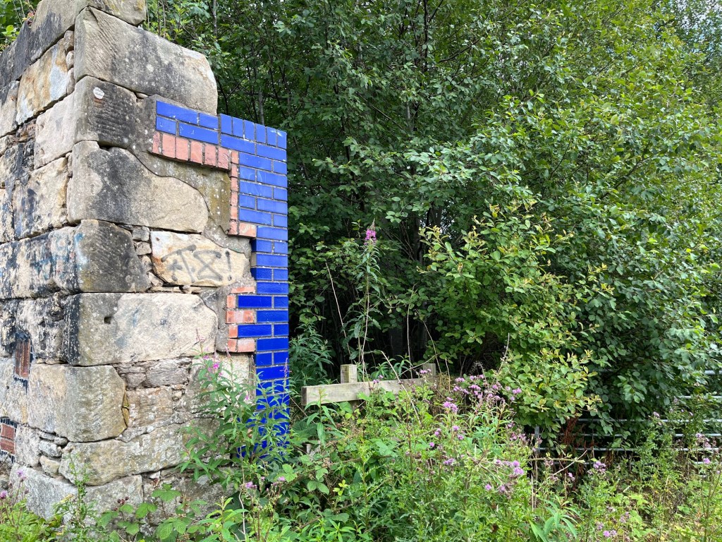
Many of the old industrial buildings along here have been reduced to piles of brick and concrete, reclaimed by the undergrowth, but others, like the clay pits, have new life.
I continue to walk the canal past the Old Basin, with arts venues such as the Glue Factory and Sculpture Studio, in the old whisky bond, nearby. Across the water is Speirs Wharf, a massive apartment building, that was once the offices of the Forth & Clyde Navigation Company and the City of Glasgow Grain Mills and Stores, before finishing my journey at what is now a watersports centre at Pinkston Basin.

I take a moment to think about the local mining industry that fuelled the initial success of this canal, where colliers were bound to employer ‘masters’, with children as well as adults working the pits, until legislation began to limit ages and hours in the 19th century.
Then, as the canal failed to keep pace with the railways and steam began to drive traffic along the water, the slow decline began. Over the next century, with the canal closing in 1963, factories and warehouses shut up shop, and unemployment and poverty soared.
Finally, any story of the Forth and Clyde Canal, as with the story of Glasgow, cannot be told without reference to the city’s role in a heinous trade, documented by Stephen Mullen in **Glasgow, Slavery and Atlantic Commerce, research carried out for the council. It was the city’s elite colonial merchants, profiting from the trafficking of enslaved African people, who funded the Glasgow branch of the canal to help improve the two-way trading of goods between America and Europe.
When we consider the history of all those people, not just in those areas that surround the canal, and the waterway’s impact on the city as a whole, we can start to see its revival as something even more than the successful tale of urban regeneration and redevelopment it clearly represents.
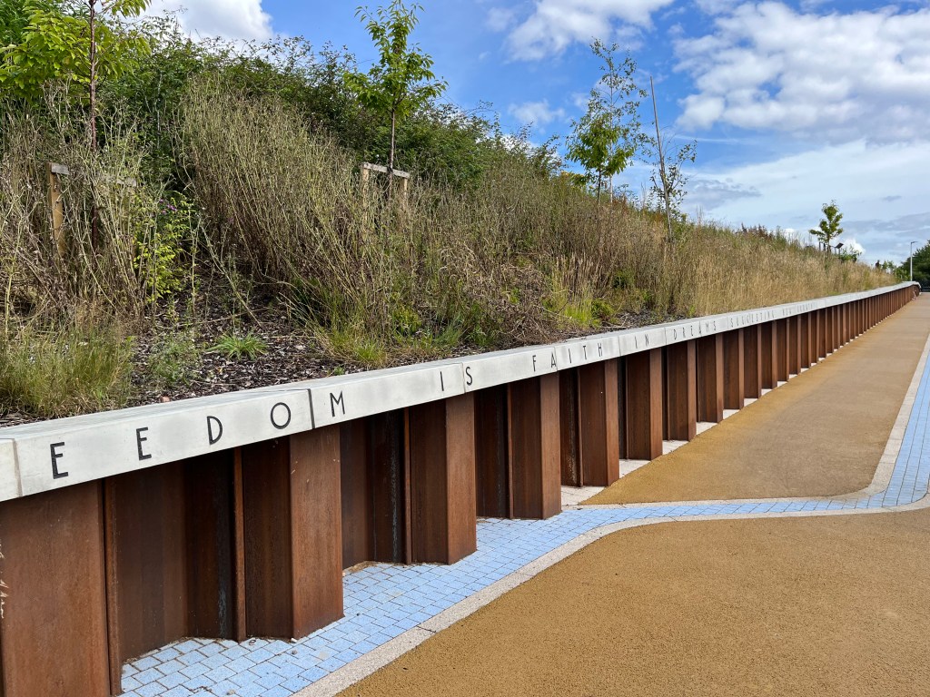
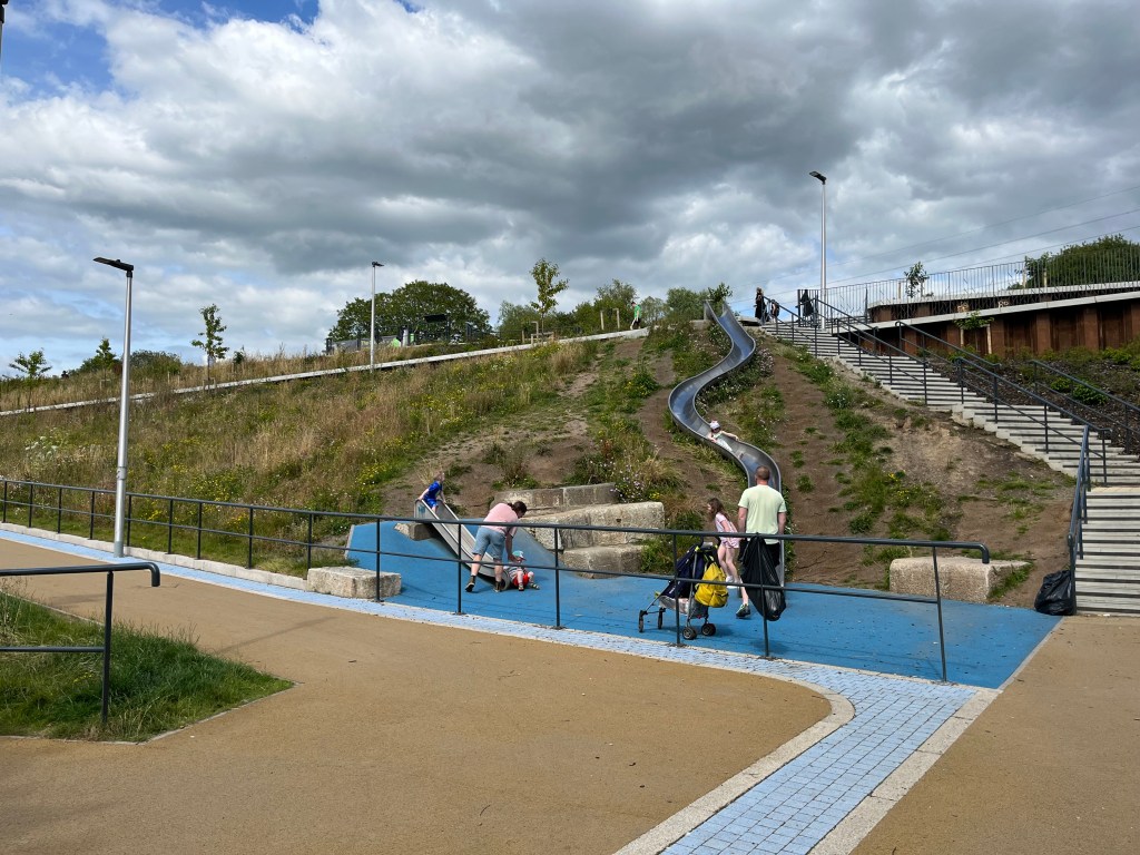
At the approach to Hamiltonhill on Garscube Road, where a huge slide connects the towpath with the street, the words of the late great Glasgow writer and artist Alasdair Gray are etched along the path to the nature reserve – “Freedom is faith in dreams suggesting new growth”.
- This walk and article was selected to be part of the Fourth World Congress of Psychogeography, September 4 2022.
* Glasgow: 1830 to 1912, edited by Thomas Martin Devine, Gordon Jackson, W. Hamish Fraser, Irene Maver, (Manchester University Press, 1995). ** Glasgow, Slavery and Atlantic Commerce: An Audit of Historic Connections and Modern Legacies (Stephen Mullen, March 2022).


You must be logged in to post a comment.