I’m taking on Social Bite’s 100-mile challenge … From September 1 to October 10, I’ll be walking 4-7 miles two-three times a week to cover 100 miles in total. I’ll finish with a route from Social Bite’s Cafe on Glasgow’s Sauchiehall Street to the Social Bite Village in Rutherglen on World Homeless Day, October 10. This challenge will raise vital funds to expand the innovative work of Social Bite in providing homes, jobs, and food. My walks will take me all over Glasgow and I’ll write about each one, exploring the histories of these neighbourhoods and some unusual street-names.
WALK 2, September 5, 5.96miles – Meteorite that rocked a peaceful place …
I walked to the site of an incredible celestial event – the fall to earth of the High Possil meteorite, the first recorded in Scotland. I began my journey on Bilsland Drive, passing Ruchill Park and also the site of the former Ruchill hospital on my right, where the distinctive A-listed water tower at the top of the hill, designed by Alexander Beith McDonald in 1892, remains in the middle of a new housing development, on my way to Balmore Road.
There I headed left, up to join the Forth and Clyde canal at the Lambhill Stables cafe. The stables were built around 1815, when it was horses pulling the boats and barges along the canal. What had once been an important staging post was renovated in 2007 when the main building was acquired by the local community. Now a busy and welcoming hub, Lambhill Stables cafe is a focus for local history info and events, in addition to being a popular cafe visited by those walking and cycling the canal, as well as the regulars.
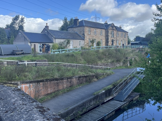
Following the towpath north, it’s not far to Possil Marsh and Possil Loch, where a fiery meteorite had burst from the sky and plunged to the ground on April 5, 1804. It’s reported a thunderous crack could be heard up to 25 miles away and nearby quarry workers had described the “fizzing” of this rock as it fell to earth. The biggest fragment of this four-and-a-half-billion years old meteorite is now in the Hunterian Museum, at the University of Glasgow.
The location of this amazing event, and also the quarry, is now a nature reserve. Standing here, in a rare spell of September sun, the wind tickling the grass and trees, and the echoes of birdcall all around, it seems appropriate the place name Possil comes from the original version Possele, Cumbric (the Brythonic Celtic language) for a place of peace or rest.
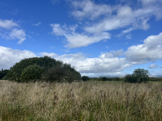
This wildlife reserve is a sanctuary to a number of varieties of birds, animals and insects, some of which may be under threat elsewhere. Scottish Wildlife Trust believe this may be Glasgow’s oldest bird sanctuary, with 150 species recorded at Possil, including the secretive water rail.
I was lucky. While trudging along the marsh route towards the loch, a water rail burst out of some long grass. Neck extended and bouncing from side to side, this shy bird charged along the path in front of me before diving back into the undergrowth. I don’t who was more startled, the water rail or me …
Intriguingly, just over the fields and the Glasgow boundary beyond Possil Marsh, near the farm that now shares its name, stood a Roman fort at Balmuildy. Traces of the ditch and the outer mound are still visible in the surrounding grounds. One of only two of the Antonine Wall’s forts to have stone ramparts, Balmuildy was also unusual in that the wall crossed the River Kelvin.
However, I was heading back along the canal and down Balmore Road again, walking through Lambhill towards Possilpark. This whole area was owned by the Glasgow bishops, gifted in the 13th century by King Alexander II. The lands known as Upper Possil, Nether (lower) Possil and Easter (eastern) Possil, eventually became an estate with a grand house owned by the Campbell family, whose wealth – as with so much of Glasgow’s built heritage – was generated through slavery and exploitation, trading in sugar and tobacco.
In the 1860s, it was this lower section of Possil land (including the grand house) that was sold to Walter Macfarlane & Co, the iron founders who were looking to relocate their Saracen Foundry which had been established in the Gallowgate. Possilpark, or simply Possil as it’s now known, grew and flourished around the ironworks at Hawthorn Street.
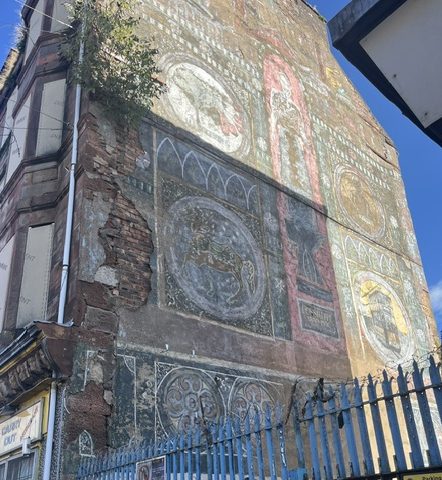
From a few dozen rural homes, within 20 years there were tenements, schools, churches, shops and other industries – a thriving community of more than 7000, hitting 10,000 plus by the time Possil was brought into Glasgow city’s jurisdiction in 1891.
The main street leading up to the works was named Saracen Street after the foundry. Of course, the ironworks had been named after their first location of Saracen Lane in the Gallowgate. That lane, which had previously been known as Brass Bell Lane, took its inspiration from the famous Saracen’s Head Inn on the corner, with the latest reincarnation of that establishment from the early 1900s and still known as the Sarry Heid. The original name, of course, is an unpleasant one, derived from stories around what was known as the crusades, Medieval wars in the Middle East.
In Possil, the foundry remained at the heart of a strong community, just as its closure almost a century later in 1966 was a terrible blow to the area. Another local employer, the Saracen or Possil pottery in Denmark Street, that had several ownership phases, finally closed in 1942.
I walked down Saracen Street to Possilpark Library, where there is a good supply of community information but, surprisingly, no reference library or local history resources. It seems a shame the library only has two displays of old photos but no stories or explanations to give them context. However, the work by renowned author, playwright, literary critic, academic and son of Possilpark Willy Maley can be found online, The Story of Possilpark.
The library itself, by architect George Simpson and opened in 1913, is one of the many to owe its existence to a Carnegie grant. Inside, the library also has a series of beautiful murals that were painted by Glasgow School of Art students just after the First World War (as does Langside library).
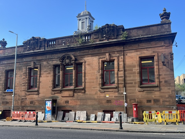
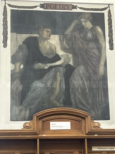
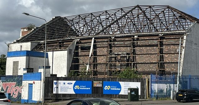
Much of the vast 14-acre Saracen foundry site, which had its main entrance at 73 Hawthorn Street, is now occupied by Allied Mobility, close to the former Vogue cinema on the corner, in a sad state and minus its roof.
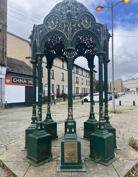
Down Saracen Street, at the junction with Balmore Road, the restored Saracen Cross Fountain has a bronze commemorative plaque at its base and the legacy of this internationally-famed foundry can be seen in the many examples of their work across the city – and beyond. The ornamental carriage canopy at Central Station’s Gordon Street entrance, the Saracen Fountain in Alexandra Park, the cast iron elements of the Kibble Palace in the Botanic Gardens, the Bailie James Martin Memorial Drinking Fountain near the People’s Palace, lamp standards at locations including the Mitchell Theatre, George Square and the People’s Palace … The list goes on, reaching bandstands, fountains and gates as far away as Argentina and India.
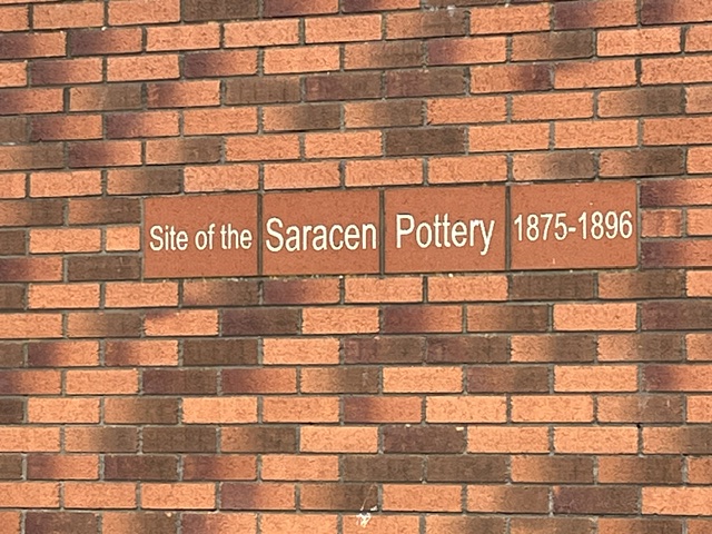
I also found a chiselled stone and brick landmark to the first Possil Pottery, in the wall of a building at the corner of Denmark and Mansion Streets. The highly-decorative porcelain of the later “Nautilus” phase was and still is acclaimed and sought after. However the pottery’s earlier stoneware and later simpler 1930s ceramics also remain popular pieces …
Back down Saracen Street, at the junction with Craighall and Keppochhill Roads, I took the right turn into Possil Road and joined the Glasgow arm of the canal. Following the waterway, I passed the Claypits urban nature reserve at Hamiltonhill, with the swan family on patrol all the way to the Firhill Basin, which was busy with youngsters and older veterans fishing for perch, pike, roach, bream and carp, as the Partick Thistle fans began to gather at the stadium below.
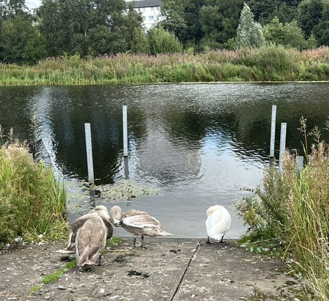
On through the Nolly Brig, the bridge named for this canal’s nickname, to the stairs at Murano Street and down to Maryhill Road and the start of Bilsland Drive again, before heading home.
WALK 1, September 3, 6.08miles – In the footsteps of the ancients …
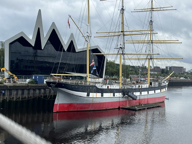
It was a rainy start to my first walk, as I headed down from Partick Cross towards the River Clyde. The sun broke through as I reached the Govan-Partick Footbridge (a swing bridge, hence nickname the Swivelly Bridge) with intriguing views, up-river beyond the Riverside Museum and the tall ship Glenlee, or down past the BAE yard, almost like an ancient relic itself, an echo from the surrounding shipyard past of Fairfield.
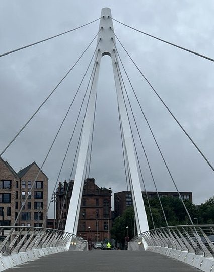
The footbridge opened two years ago, and with more than one million crossings in the first eight months, locals and visitors have made the most of this vital link between the two former burghs that were always inter-dependent. The small boats and low-tide paths across sandbanks of the earliest peoples would eventually be replaced by passenger ferries, the dozen or so Cluthas that operated along the Clyde, after the river had been blasted and dredged to create more depth for shipping in the second half of the 19th century.
Then came the first Clyde Tunnel in 1895 – still marked by the magnificent rotunda buildings at Finnieston and in Govan – for horses and carts as well as those on foot, with the pedestrian access not closing until 1980. But it was the 1963 opening of the next Clyde Tunnel that spelled the end for the ferries, and perhaps also for that strong connection between Partick and Govan, that had spanned more than 1500 years. I can’t have been the only child to look up at my school building, on the north side of the river, and wonder why the words ‘Govan Parish School Board’ were carved into the red sandstone.
These thriving burghs were among the last areas to be incorporated into the city of Glasgow, in 1912, and understandably, not everyone was delighted to lose that autonomy. The eventual loss of the shipbuilding industry would hit Govan hardest, along with the M8 and new road systems cutting through the tenements and businesses, as the Expressway did to a lesser extent in Partick. The opening of the footbridge has restored that link, and is part of a wider regeneration south of the river, with the Govan Heritage Project building on other initiatives.
When you step off the footbridge in Water Row, you could walk south-east along Napier Drive and Clydebrae Street to the Govan Graving Docks and Pump House, where investment will create a new riverside park with plans also to bring the docks – unused for 40 years aside from their starring role in scenes from the film 1917 – back into community use.
Or you could follow my path in the opposite direction, just a few hundred yards along the Govan Old Walkway by the river, to the A-listed Govan Old Parish Church, built by architect Robert Rowand Anderson in 1888. Ongoing excavation, which has involved the University of Glasgow for more than 25 years, has shown this historic building is possibly the sixth church built on this site, and that from the fifth century, this location and its graveyard was at the heart of the Celtic-Brittonic Kingdom of Strathclyde.
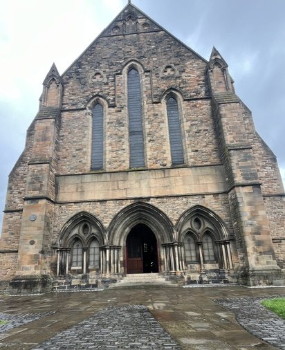
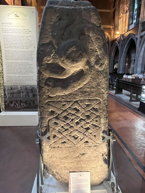
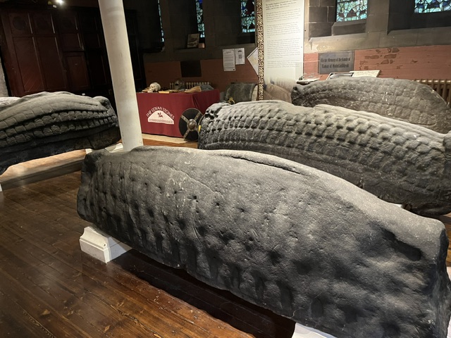
This is now a heritage centre for the Govan Stones, which are of local, national and international significance. Here you can see early medieval monuments up to the 11th century, including the sixth-century sarcophagus thought to have held the remains of Constantine, a saint or a king of Strathclyde, and the amazing hogback burial sculptures from the Viking-era ninth century. Visiting here is an enchanting experience, and one that again underlines the ancient link between Govan and Partick.
Social enterprise Govan Workspace, which led the community drive to rescue Govan Old, also manages the Fairfield Heritage community museum, which tells the story of Govan’s world-leading role in shipbuilding, at what were once the Fairfield offices, built by architect John Keppie in 1891, nearby in Govan Road.
Walking back to the footbridge, I pause for a moment at Water Row to imagine the 30-foot Doomster Hill that sat here, possibly heaped upon an older burial mound, until it was flattened by shipbuilding’s advance in the 1850s. Doomster was a place where royalty and religious leaders met with local people, sometimes to deliver justice or key decisions. Strathclyde royalty crossed the Clyde from Partick, just by the River Kelvin, where a 12th-century castle would later form the Bishops’ Palace.
Back over the bridge I take the path past the Riverside Museum, signposted to Yorkhill, veering right under the expressway and out by the rail bridge, eventually taking a left through the arches. Just ahead, to the right, is Centurion Way. This was a new area of housing development in 2014, and housing and council bosses gave the kids in nearby St Peter’s Primary School, who had been exploring the history of the old railway site and the former Yorkhill House, the chance to come up with a name for the road.
It was originally thought the Romans, who didn’t last long this far north, retreating from the Antonine Wall and their settlements within 20 years of its construction in the latter part of the second century, may have had a look-out point here. In 1868, workmen on the hill found Roman coins and pottery amid some earthworks. However, it’s also argued this could have been a Kingdom of Strathclyde stronghold, or an even earlier one from the Iron Age, with these finds the result of later local trading with Antonine Wall residents. It seems James Napier, an engineer and scientific writer, possibly supported the first theory. He wrote in his 1873 book Notes and Reminiscences Relating to Partick, that items including fragments of a sword had been found by people in Bridgend – an area close to where the Kelvin Hall and Bunhouse Road now are – when digging in their gardens. Locals thought they’d been left by Covenanters … but Napier suggested they may have been Roman.
Turning left through the middle of the Centurion Way flats, a wee twist right at the back takes you up the steps and heading back towards Partick again, up and over the hill in Yorkhill Park, with the former children’s hospital high on your right.
The hospital and its grounds, which had most recently been used as the West Glasgow Ambulatory Care Hospital after the children’s services were moved to the new Queen Elizabeth University hospital in 2015, are destined to become a new housing development. I can still remember the previous Yorkhill hospital though, which dated from 1914. Structural problems led to its demolition and replacement by this Royal Hospital for Sick Children in the early 1970s, along with the Queen Mother’s Maternity Hospital that opened next door in 1966.
Out of the park and over the road to cross the Kelvin on the iron bridge at Benalder Street, with what’s left of the Bishop Mills, built in 1839 for miller and grain merchant William Wilson, on the right. Some of the building didn’t survive but you can still see wheatsheaf finials high on the main section, which was converted into flats.
Due west again, where at the edge of Castlebank Street, amid the towering developments of student accommodation, Partick Castle was finally revealed in an excavation 10 years ago. The 17th-century tower house was built upon the site of the 12th-century bishops of Glasgow residence, which itself may have sat upon a Kingdom of Strathclyde settlement. Guard Archaeology described the findings as of “national significance” that provided “a rare glimpse into the medieval beginnings of Partick and Glasgow”.
Marching on again, I’m hoping to find what’s left of the boarding point for the old Meadowside ferry, which closed in 1966. The walk takes me along the riverside at Glasgow Harbour and Granary Quay flats, which replaced the four huge buildings of the granary that were built over more than 50 years from 1911, becoming the largest brick buildings of their time in Europe. Demolished in 2002, the buildings also had a predecessor on this Meadowside Quay site…
Football club Partick Thistle played here, one of several grounds for the side that ended up putting down roots a little further north. Thistle began playing at Overnewton Park, in Yorkhill, in 1876 before a series of flits led to Meadowside in 1897 and on to their permanent home Firhill, in Maryhill, in 1908.
My Meadowside mission will have to wait, as I was then halted by a hoarding at the edge of the Granary Quay development. Instead, I turned back up towards Dumbarton Road, walking past Meadow Road, formerly Mauldslie Street, and Sandy Road, renamed from Clyde Street, on my right, both leading south towards Beith Street and Meadowside and the river beyond, as the names suggest.
The rain was on again as I set out towards Partick Cross and the end of my walk, before heading home – just over 93 miles to go now!


You must be logged in to post a comment.