I’m taking on Social Bite’s 100-mile challenge … From September 1 to October 10, I’ll be walking 4-7 miles two-three times a week to cover 100 miles in total. I’ll finish with a route from Social Bite’s Cafe on Glasgow’s Sauchiehall Street to the Social Bite Village in Rutherglen on World Homeless Day, October 10. This challenge will raise vital funds to expand the innovative work of Social Bite in providing homes, jobs, and food. My walks will take me all over Glasgow and I’ll write about each one, exploring the histories of these neighbourhoods and some unusual street-names.
WALK 1, September 3, 6.08miles – In the footsteps of the ancients …
It was a rainy start to my first walk, as I headed down from Partick Cross towards the River Clyde. The sun broke through as I reached the Govan Footbridge with intriguing views, up-river beyond the Riverside Museum and the tall ship Glenlee, or down past the BAE yard, almost like an ancient relic itself, an echo from the surrounding shipyard past of Fairfield.
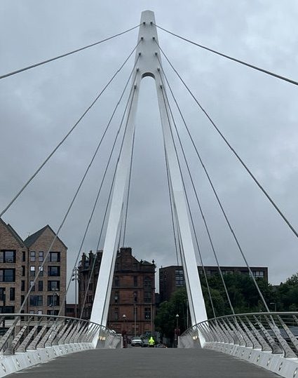
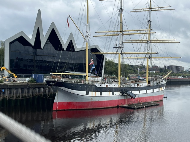
The footbridge opened two years ago, and with more than one million crossings in the first eight months, locals and visitors have made the most of this vital link between the two former burghs that were always inter-dependent. The small boats and low-tide paths across sandbanks of the earliest peoples would eventually be replaced by passenger ferries, the dozen or so Cluthas that operated along the Clyde, after the river had been blasted and dredged to create more depth for shipping in the second half of the 19th century.
Then came the first Clyde Tunnel in 1895 – still marked by the magnificent rotunda buildings at Finnieston and in Govan – for horses and carts as well as those on foot, with the pedestrian access not closing until 1980. But it was the 1963 opening of the next Clyde Tunnel that spelled the end for the ferries, and also for that strong connection between Partick and Govan, that had spanned more than 1500 years. I can’t have been the only child to look up at my school building, on the north side of the river, and wonder why the words ‘Govan Parish School Board’ were carved into the red sandstone.
These thriving burghs were the last areas to be incorporated into the city of Glasgow, in 1912, and understandably, not everyone was delighted to lose that autonomy. The eventual loss of the shipbuilding industry would hit Govan hardest, along with the M8 and new road systems cutting through the area, as the Expressway did to a lesser extent in Partick. The opening of the footbridge has restored that link, and is part of a wider regeneration south of the river, with the Govan Heritage Project building on other initiatives.
When you step off the footbridge in Water Row, you could walk east along to Napier Drive and Clydebrae Street to the Govan Graving Docks and Pump House, where investment will create a new riverside park with plans also to bring the docks – unused for 40 years aside from their starring role in scenes from the film 1917 – back into community use.
Or you could follow me west along the Govan Old Walkway by the river, to the A-listed Govan Old Parish Church, built by architect Robert Rowand Anderson in 1888. Ongoing excavation, which has involved the University of Glasgow for more than 25 years, has shown this historic building is possibly the sixth church built on this site, and that from the fifth century, this location and its graveyard was at the heart of the Celtic-Brittonic Kingdom of Strathclyde.
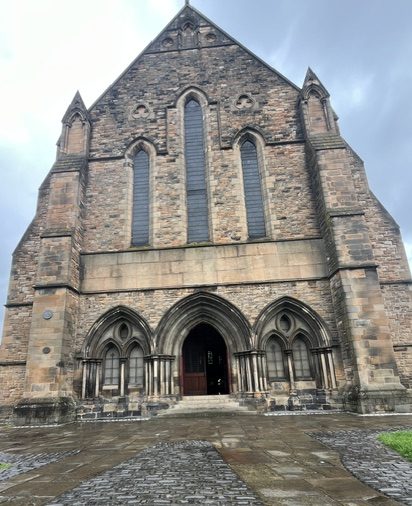
This is now a heritage centre for the Govan Stones, which are of local, national and international significance. Here you can see early medieval monuments up to the 11th century, including the sixth century sarcophagus thought to have held the remains of Constantine, a saint or a king of Strathclyde, and the amazing hogback burial sculptures from the Viking-era ninth century. Visiting here is a magical experience, and one that again underlines the ancient link between Govan and Partick.
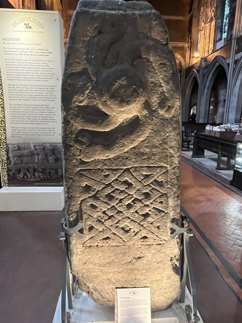
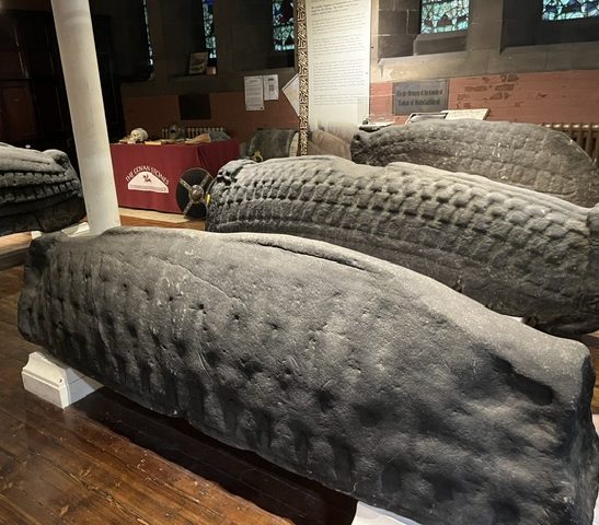
Social enterprise Govan Workspace, which led the community drive to rescue Govan Old, also manages the Fairfield Heritage community museum, which tells the story of Govan’s world-leading role in shipbuilding, at what were once the Fairfield offices, built by architect John Keppie in 1891, nearby in Govan Road.
Walking back to the footbridge, I pause for a moment at Water Row to imagine the 30-foot Doomster Hill that sat here, possibly heaped upon an older burial mound, until it was flattened by shipbuilding’s advance in the 1850s. Doomster was a place where royalty and religious leaders met with local people, sometimes to deliver justice or key decisions. Strathclyde royalty crossed the Clyde from their stronghold in Partick, just by the River Kelvin, where a 12th century castle would later form the Bishops’ Palace.
Back over the bridge I take the path past the Riverside Museum, signposted to Yorkhill, veering right under the expressway and out by the rail bridge, eventually taking a left through the arches. Just ahead, to the right, is Centurion Way.
This was a new area of housing development in 2014, and housing and council bosses sensibly decided to let the kids in nearby St Peter’s Primary School, who had been exploring the history of this old railway site and the former Yorkhill House, come up with a name for the road. It was originally thought the Romans, who didn’t last long this far north, retreating from the Antonine Wall and their settlements within 20 years of its construction in the latter part of the second century, may have had a look-out point here.
In 1868, workmen on the hill found Roman coins and pottery amid some earthworks. However, it’s also argued this could have been a Kingdom of Strathclyde stronghold, or an even earlier one from the Iron Age, with these finds the result of later local trading with Antonine Wall residents.
One more point to consider, though. James Napier, an engineer and scientific writer, wrote in his 1873 book Notes and Reminiscences Relating to Partick, that items including fragments of a sword had been found by people in Bridgend – an area close to where the Kelvin Hall and Bunhouse Road now are, when digging in their gardens. Locals thought they’d been left by Covenanters … but Napier suggested they may have been Roman.
Turning left up through the middle of the Centurion Way flats, a wee twist right at the back takes you up the steps and heading west again, up and over the hill in Yorkhill Park, with the former Children’s Hospital high on your right.
The hospital and its grounds, which had recently been used as the the West Glasgow Ambulatory Care Hospital after the children’s services were moved to the new Queen Elizabeth University hospital in 2015, are destined to become a new housing development. I can still remember the old Yorkhill hospital though, which dated from 1914. Structural problems led to its demolition and replacement by this Royal Hospital for Sick Children in the early 1970s, along with the Queen Mother’s Maternity Hospital that opened next door in 1966.
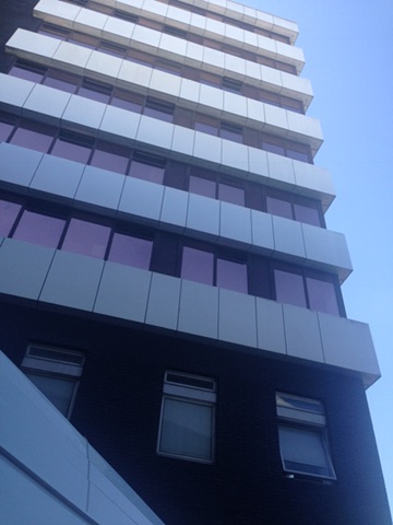
Out of the park and over the road to cross the Kelvin on the iron bridge at Benalder Street, with what’s left of the Bishop Mills, built in 1839 for miller and grain merchant William Wilson, on the right. Some of the building didn’t survive but you can still see wheatsheaf finials high on the main section, which was converted into flats.
West again, where at the edge of Castlebank Street, amid the towering developments of student accommodation, Partick Castle was finally revealed in an excavation 10 years ago. The 17th century tower house was built upon the site of the 12th century bishops of Glasgow residence, which itself may have sat upon a Kingdom of Strathclyde settlement. Guard Archaeology described the findings as of “national significance” that provided “a rare glimpse into the medieval beginnings of Partick and Glasgow”.
Marching west again, I’m hoping to find what’s left of the boarding point for the old Meadowside ferry, that closed in 1966. The walk takes me along the riverside at the Glasgow Harbour and Granary Quay flats, that replaced the four huge buildings of the granary that were built over more than 50 years from 1911, becoming the largest brick buildings of their time in Europe. Demolished in 2002, the buildings also had a predecessor on this Meadowside Quay site…
Football club Partick Thistle played here, one of several grounds for the side that ended up putting down roots further north. Thistle began playing at Overnewton Park, in Yorkhill, in 1876 before a series of flits led to Meadowside in 1897 and on to their permanent home Firhill, in Maryhill, in 1908.
My other Meadowside mission will have to wait, as I was then halted by a hoarding at the edge of the Granary Quay development. Instead, I turned back up towards Dumbarton Road, walking past Meadow Road, formerly Mauldslie Street, and Sandy Road, renamed from Clyde Street, on my right, both leading south towards Beith Street and Meadowside and the river beyond.
The rain is on again as I set out towards Partick Cross and the end of my walk, before heading home – just over 93 miles to go now!
 Ginny Clark
You must be logged in to post a comment.